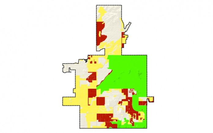
During the public outreach process, there was an expressed interest by residents to preserve the large lot, rural lifestyle found predominantly in north Scottsdale. These areas are currently designated as “Rural Neighborhoods” in the 2001 General Plan.
To preserve the larger lot Rural Neighborhood areas, the draft plan proposes the “Rural Neighborhoods” land use category be split into two land use categories with different development densities.
“Rural Neighborhoods” densities are proposed to be one house per one to two acres, and “Desert Rural Neighborhoods” are proposed to be one house per two or more acres. Properties that are currently designated as “Rural Neighborhoods” and have a zoning classification of R1-130 or R1-190 would be placed in the new “Desert Rural Neighborhoods” land use category.
If approved by the City Council and ratified by voters, a General Plan amendment process would be required to change the land use category from Desert Rural Neighborhoods to any other category, including Rural Neighborhoods. You can view these proposed changes in the “Redline Scottsdale General Plan 2035”.
This proposed General Plan land use category change would not affect existing legal land use entitlements, such as current zoning. However, under the proposed new General Plan, should a property owner make an application to change the current land use entitlements, and the proposed density does not align with the Desert Rural category, it would require an additional application for a General Plan amendment. This process includes, but is not limited to, public hearings before the Planning Commission and, ultimately, approval by the City Council.
Comparison between the two land use designations
| Existing Rural Neighborhoods |
Proposed Desert Rural Neighborhoods |
- The existing 2001 Rural Neighborhoods land use category has a density that is usually one dwelling per one or more acres.
|
- The proposed Desert Rural Neighborhoods land use category has a density of one dwelling per two or more acres.
|
- Properties that are located in Rural Neighborhoods can develop or rezone to this density without a General Plan Amendment. Properties that are zoned R1-130 or R1-190 generally allow for one dwelling per three or 4.5 acres, respectively, and would need to be rezoned to allow for additional dwellings.
|
- Properties zoned R1-130 or R1-190 would be in this land use category. As with the existing 2001 Rural Neighborhoods, properties zoned R1-130 or R1-190 generally allow for one dwelling per three or 4.5 acres, respectively, and the proposed change would require a Major General Plan amendment and rezoning to allow for additional dwellings.
|
- The process for rezoning typically takes four to six months. It requires a pre-application conference with city staff, neighborhood notification and involvement, submittal of an application, staff review and potential resubmittal for any additional materials required or to address issues, Planning Commission recommendation, and City Council approval. It could also be subject to other development review processes.
|
- A Major General Plan amendment is, per state statute, a process that cities are required to have only once each calendar year. In addition to the requirements for a rezoning, a major amendment requires an additional remote Planning Commission hearing, a 2/3 majority of City Council (5 out of 7) to adopt the major amendment, and enhanced notification to surrounding jurisdictions.
|
|
- Currently, Scottsdale requires applications for a Major General Plan amendment to be submitted in May. The Planning Commission holds the Remote and Recommendation hearings in October, and the City Council holds the Adoption hearing in early December. Typically, the rezoning runs concurrently with this process.
|


